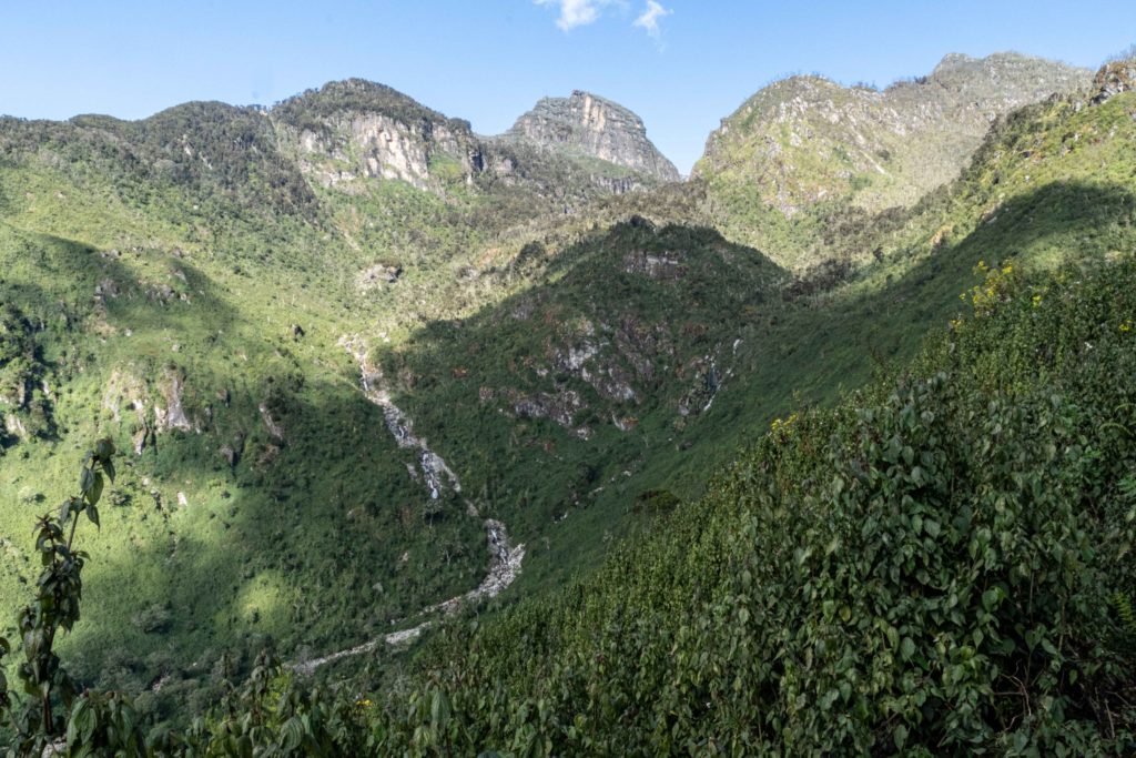
Mount Baker
Mount Baker, alongside Mount Stanley & Mount Speke, forms a triangular shape that surrounds the upper Bujuku Valley. In 2020, Klaus Thymann’s expedition confirmed that there were no glaciers present on Mount Baker and Mount Speke. Thymann employed similar images to illustrate the disappearance of two out of Africa’s five glaciated peaks.
Africa’s sixth highest summit, reaching an elevation of 4,844 meters (15,892 feet). It creates a triangular shape when combined with Mount Stanley and Mount Speke, surrounding the upper Bujuku Valley. Mount Stanley is the nearest mountain, situated 2.26 kilometers (1.40 miles) westward. The mountains are situated in a geographical area commonly referred to as “The Mountains of the Moon.”
Africa’s sixth highest summit, reaching an elevation of 4,844 meters (15,892 feet). It creates a triangular shape when combined with Mount Stanley and Mount Speke, surrounding the upper Bujuku Valley. Mount Stanley is the nearest mountain, situated 2.26 kilometers (1.40 miles) westward. The mountains are situated in a geographical area commonly referred to as “The Mountains of the Moon.”
The indigenous tribe in western Uganda known as the Bakonjo refer to the mountain as “Kiyanja,” both in the past and present. During his journey into Ruwenzori in June 1891, Franz Stuhlmann observed a peak which he referred to as either “Semper” or “Ngemwimbi.” The summit was named in honor of Samuel Baker, a British explorer from the 19th century. He was the first European to discover and visit Lake Albert in 1864, which is located about northeast of the Ruwenzori Mountains. Baker reported seeing “enormous mountainous masses in the southern direction of Lake Albert.”

The trip commences at the Kilembe trailhead, which serves as the base camp, following our arrival by air from Entebbe. Adventurers are required to pay a daily admission fee of US$35 by the Uganda Wildlife Authority. When you make a reservation for your thrilling experience with us, we handle all the necessary arrangements and details.
We ascend to Sine Camp, which is situated at an elevation of 2,596 meters above sea level, after hiking a distance of 1,146 meters. We will be staying at this location overnight. On the second day of our hike, we ascend to Mutinda camp, situated at an elevation of 3,588 meters, offering a stunning panoramic view.
On the next day, we will go to Bugata Camp, which is situated at an elevation of 4,062 meters. Along the way, we will traverse a valley that is abundant with diverse fauna, flowing streams, and cascading waterfalls. The terrain becomes increasingly challenging at this juncture, characterized by steep inclines and marshy areas that need to be traversed.
Nevertheless, this particular segment of the tour is exceptionally stunning. On the fourth day, we ascend to Hunwick’s Camp at an elevation of 3,974 meters, crossing the Bamwanjara pass, which provides breathtaking vistas of the majestic snow-covered summits. The majestic Mount Baker will be visible.
Hikers depart from the camp at an early hour in order to ascend to the summit of Mount Baker, which stands at an elevation of 4,844 meters. The climb from Hunwick’s Camp to the summit typically requires approximately five hours, while the descent usually takes around three hours. You will remain at Hunwick’s Camp for an additional night. During your descent, you will follow the same path back to Bugata Camp.
The mountains originated approximately three million years ago due to faulting during the late Pliocene period. This occurred when a raised section of crystalline rocks, including gneiss, amphibolite, granite, and quartzite, underwent a geological process. The Rwenzori Mountains hold the distinction of being the highest mountains in the world that are not formed by volcanic activity or tectonic forces.
